 Click on the map to enlarge it.
Hike leader: Jennifer Rowbotham
Date: July 10
Click on the map to enlarge it.
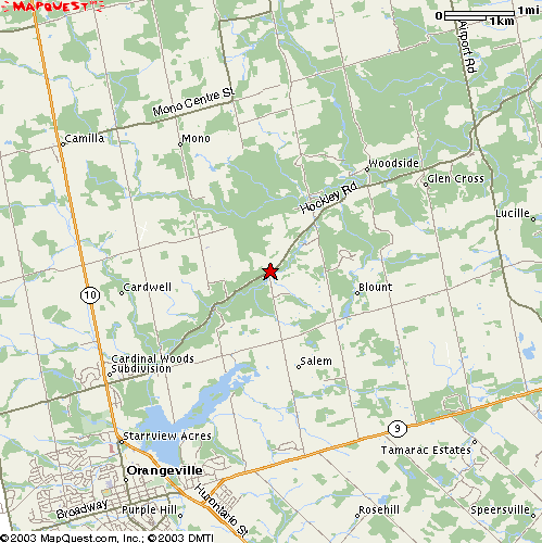
Note: 2nd Line EHS intersects at an angle running from the SW into Hockley Rd, so keep watch on the odometer. If you've gone 5 kilometers, you've gone too far! And if you reach Airport Road (alternate route up to Hockley Rd), about 11 kilometers from east of Highway 10, you've really missed the starting point!
Fairly difficult.
This hike is also sometimes call Hockley Valley. It runs up and down hills mostly. The area is mostly wooded with good shade. Hiking boots are recommended.
Bring lots of water.
11:30 a.m.
None.
We can stop afterwards at Mono Cliffs Inn at Mono Centre or maybe Kelseys on Highway 10 outside Orangeville.
![]()
![]() The High Park Hiking Club.
This web page is maintained by
Howard Gibson.
Last modified: 2005Jul13
The High Park Hiking Club.
This web page is maintained by
Howard Gibson.
Last modified: 2005Jul13